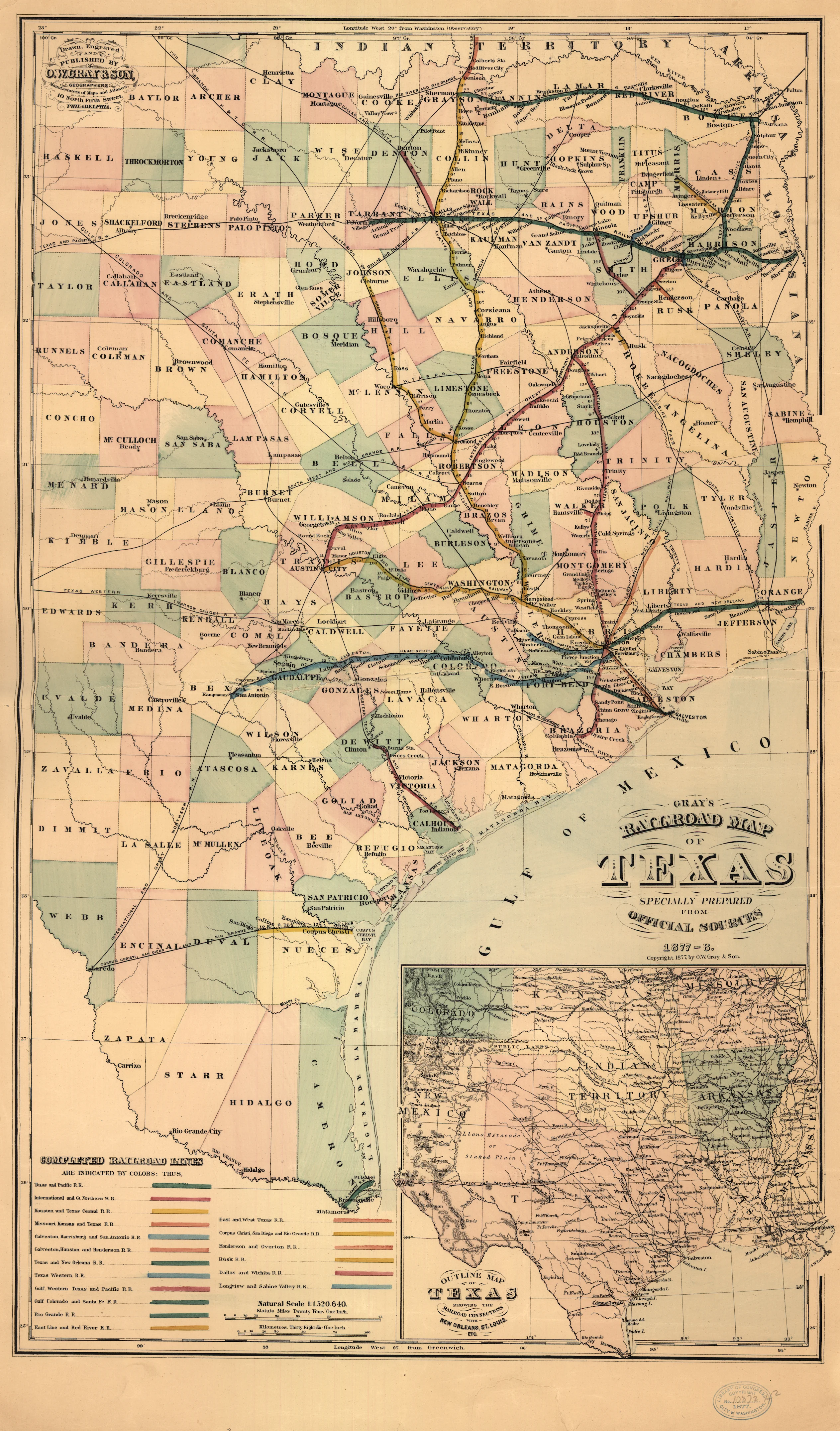
Gray’s Railroad Map of Texas, published in 1878, records the state’s rail network midway through its transformation from a scattered collection of coastal short lines into a system spanning the state. The map’s hand-colored legend identifies 18 completed railroads, ranging from major trunk lines such as the Texas and Pacific and the Houston and Texas Central to short lines of a dozen miles or less.
Texas came late to railroad building. The state’s first line did not open until 1853, and by the outbreak of the Civil War Texas had only about 470 miles of track, nearly all of it concentrated around Houston and Galveston. Texas lay far from the established rail networks of the eastern states. Its population was sparse, and much of its territory remained contested frontier. The Civil War halted construction entirely and left the existing lines worn out or bankrupt.
Construction resumed in the 1870s. The Missouri, Kansas & Texas Railway crossed the Red River at Denison in December 1872, giving Texas its first direct connection to the national rail network. The Constitution of 1876 restored the state’s land-grant policy, offering railroads sixteen sections of public land per mile of track, and investment and imigration accelerated.
The Red River War of 1874–75 also shaped the network the map depicts. The surrender of the last free Comanche and Kiowa bands in June 1875, ended decades of raiding that had confined Anglo settlement to the eastern half of the state. With the plains open, the Texas & Pacific built into Fort Worth in 1876 and prepared its push across West Texas, while a line from Galveston reached San Antonio in 1877, ending that city’s isolation from the network.
The map was produced by O.W. Gray & Son, a Philadelphia firm whose atlases were among the most commercially successful of the 1870s. Gray copyrighted the map in 1877 and issued it dated ‘1877–8’; it depicts rail lines completed as late as the spring of 1878.