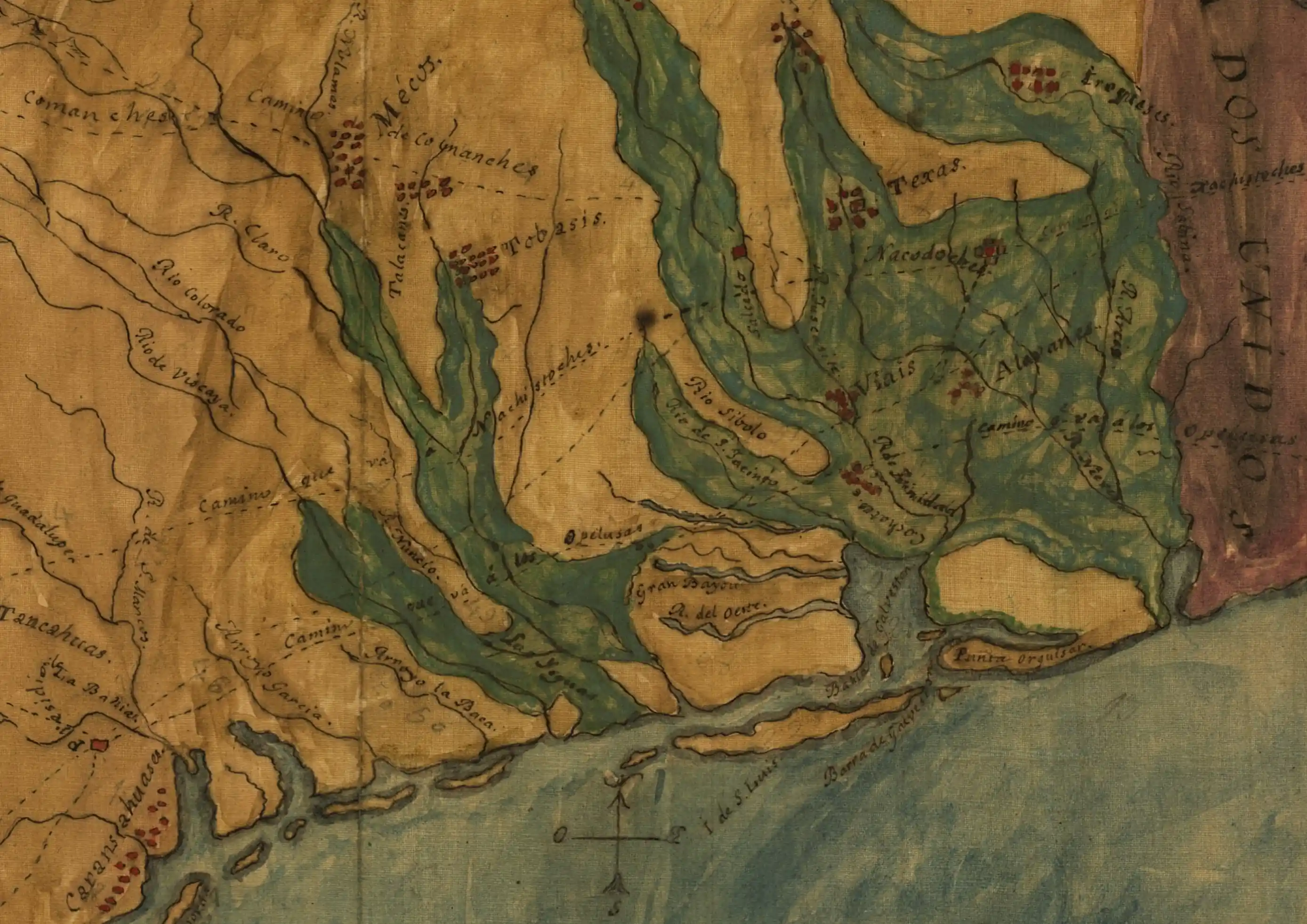
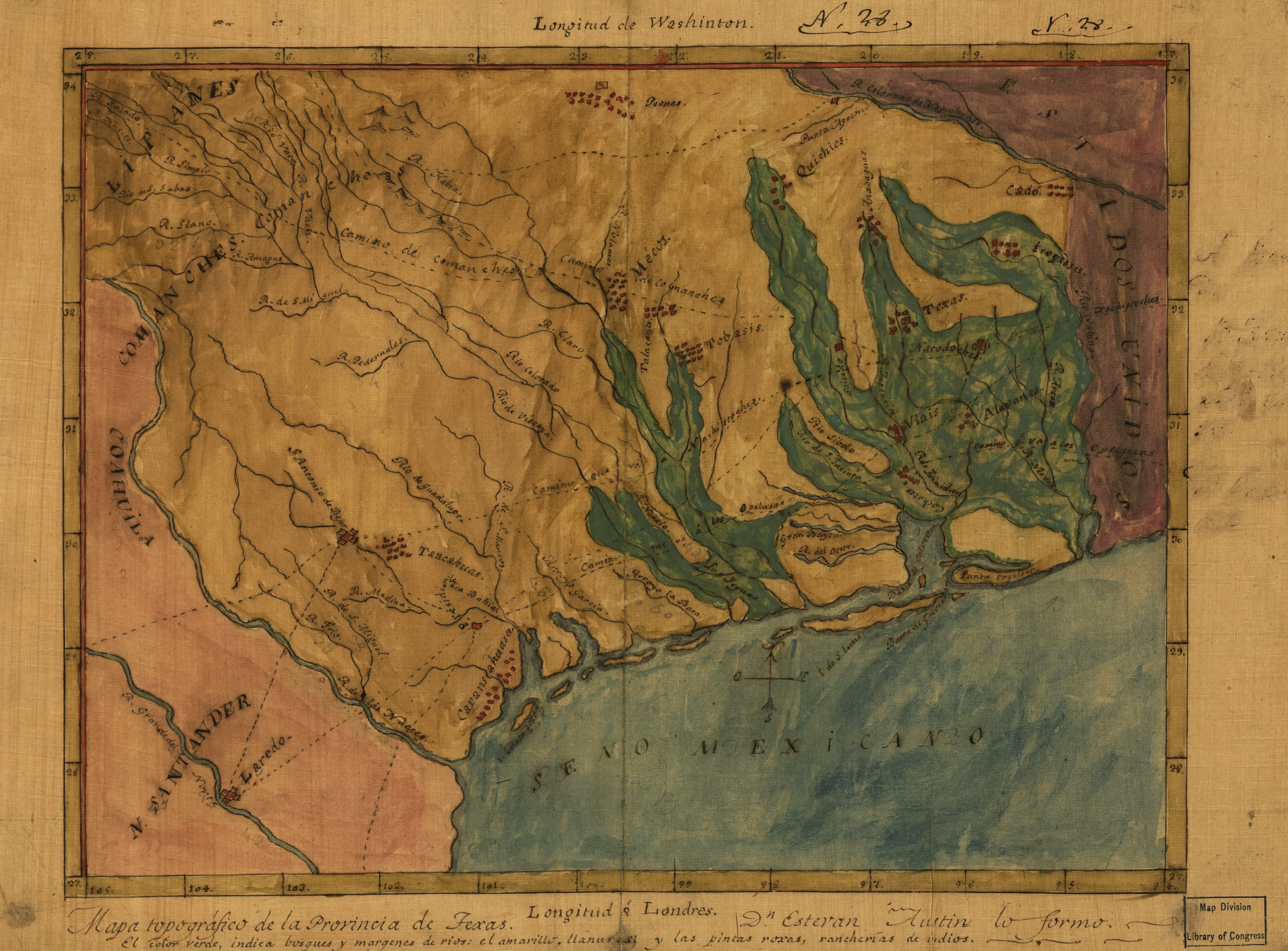
Spanish-speaking settlements occupied only small parts of Texas at the time of Mexican Independence in 1821, before the first Anglo-American colonization. San Antonio, La Bahía, Laredo, and Nacogdoches are the only Spanish settlements indicated on this map, which Stephen F. Austin drew after his first journey to Texas that same year. The settlements indicated with red dots belonged to Native American tribes.
No Anglo settlements are indicated on this map, which suggests that it predates the first American colonization in eastern Texas (or coincides with the arrival of the earliest settlers). The purple area on the right is labeled “United States.” This is Louisiana, which was the launching point for the earliest wave of American immigration to Texas.
Authorship and Dating
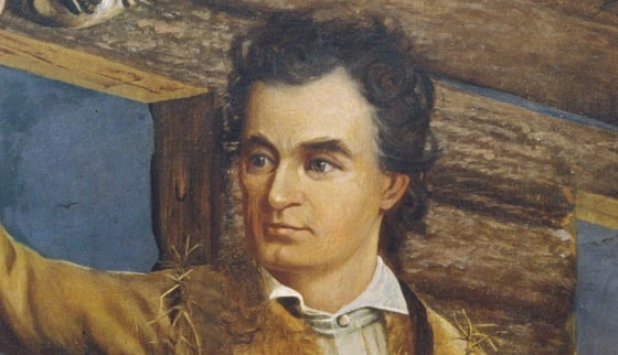
The exact date of the map and its history are uncertain, but an approximate date of 1822-1824 is likely. The authorship is fairly clear from the statement “Don Estevan lo formó” (Sir Stephen made it). Stephen F. Austin was the first American empresario in Texas and the leader of the colony that became the largest and most successful.
Austin took notes and sketches during his early travels in Texas. However, the level of geographic detail on this map goes beyond what Austin would have seen first-hand, suggesting that he probably also consulted Spanish colonial maps. Austin later commissioned professional surveyors and worked with professional map-makers. In contrast to his later maps, this one is more rudimentary and does not appear to have been intended for publication.
After his first trip to Texas in 1821, Austin returned to New Orleans, where he began recruiting colonists. Then he traveled to Mexico City to secure permission from Mexican authorities to honor his late father’s contract with the Spanish colonial government. Austin likely completed this map during a year-long stay in Mexico City in 1822-1823. The map title and legend are both written in Spanish, and the author refers to himself as “Don Estevan.” This indicates that the map was intended for a Spanish-speaking audience (likely the Mexican authorities to whom Austin was pitching this plans at the time). It also points to the bi-national identity that the young empresario had begun to embrace. In the years to come, Austin kept all the official records of his colony in Spanish.
Manuscript Information
The Library of Congress’s Geography and Map Division holds this particular manuscript and digitized the image presented here. It was drawn in pen-and-ink and watercolor.
According to the legend at the bottom of the map, the green color indicates forests and river valleys and the yellow indicates open plains. During this first journey to Texas, Austin was struck by the rich soils of the eastern Texas river valleys and ultimately situated the capital of his new colony, San Felipe de Austin, on the banks of the Brazos River.
This article is part of Texapedia’s curated primary source collection, which makes accessible both famous and forgotten historical records. Each source is presented with historical context and manuscript information. This collection is freely available for classroom use, research, and general public interest.