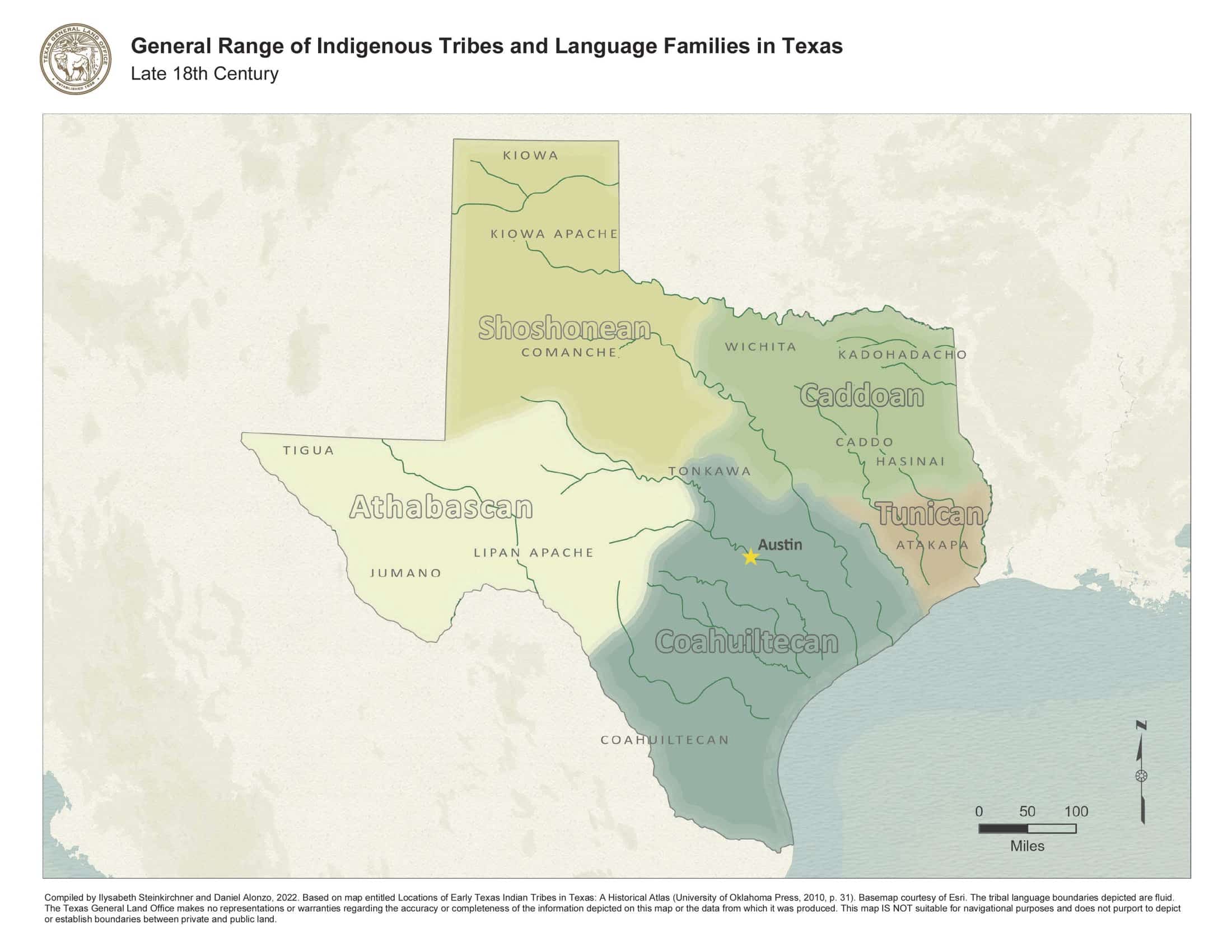
This maps show the general range of Native tribes in Texas in the 1700s, before the major waves of Anglo migration in the 19th century, which transformed Texas’ culture, demography, landscape, and politics. It was created by cartographers at the Texas General Land Office in 2022, based on earlier records. It shows the major language families in Texas and the general range of indigenous tribes in the late 1700s.
Spanish settlements, located in the south and east of Texas, are not shown.
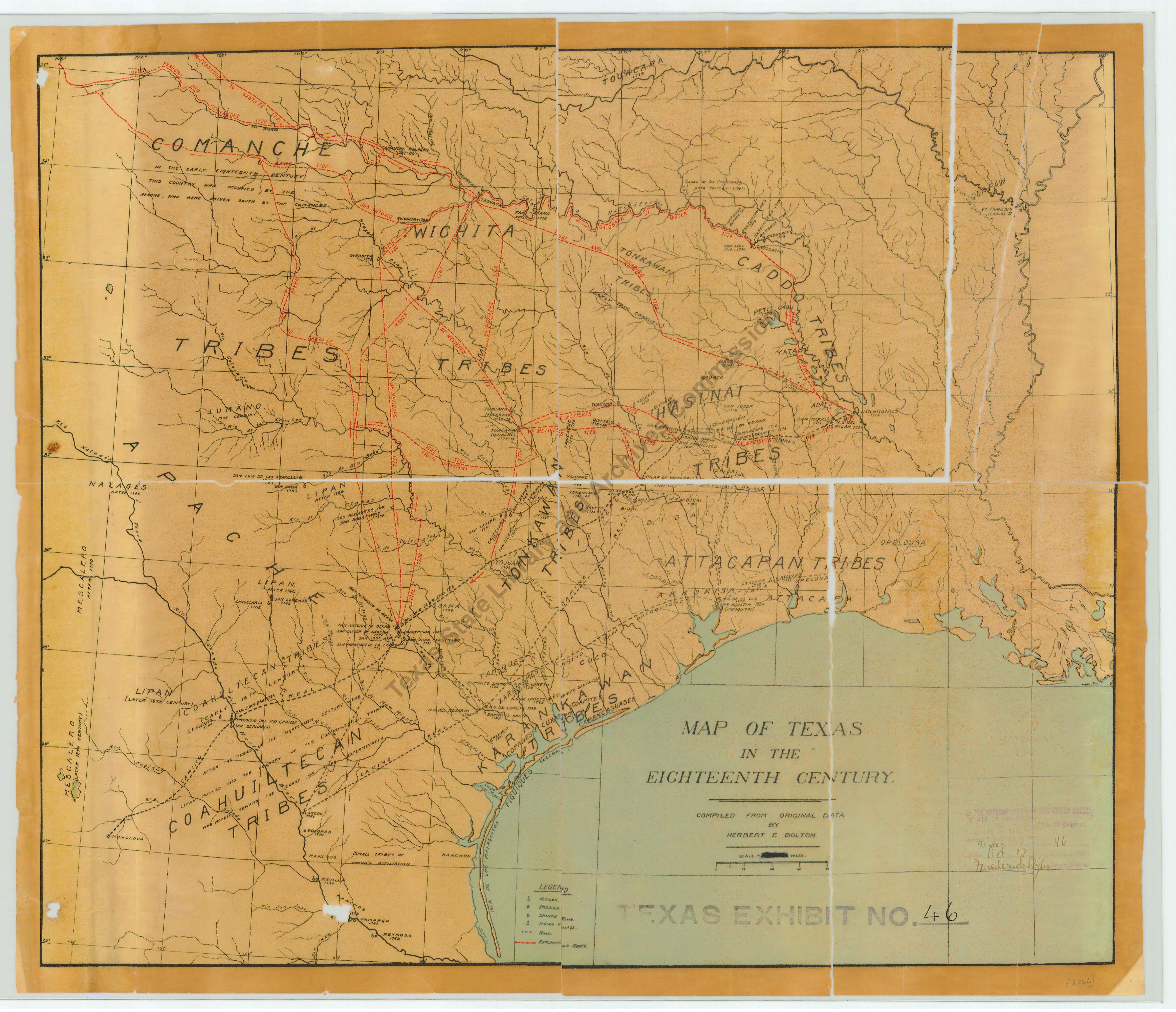
Similar to the map above, the below map identifies the general range of some American Indian tribes in the 1700s, as well as rivers, American and Spanish towns, missions, presidios, routes and trails, including those of explorers’ expeditions. This map was created by the cartographer Herbert E. Bolton in about 1915. It was used by the Texas Attorney General during a boundary dispute between Oklahoma and Texas. The physical version of this map is held by the Texas State Library and Archives Commission.