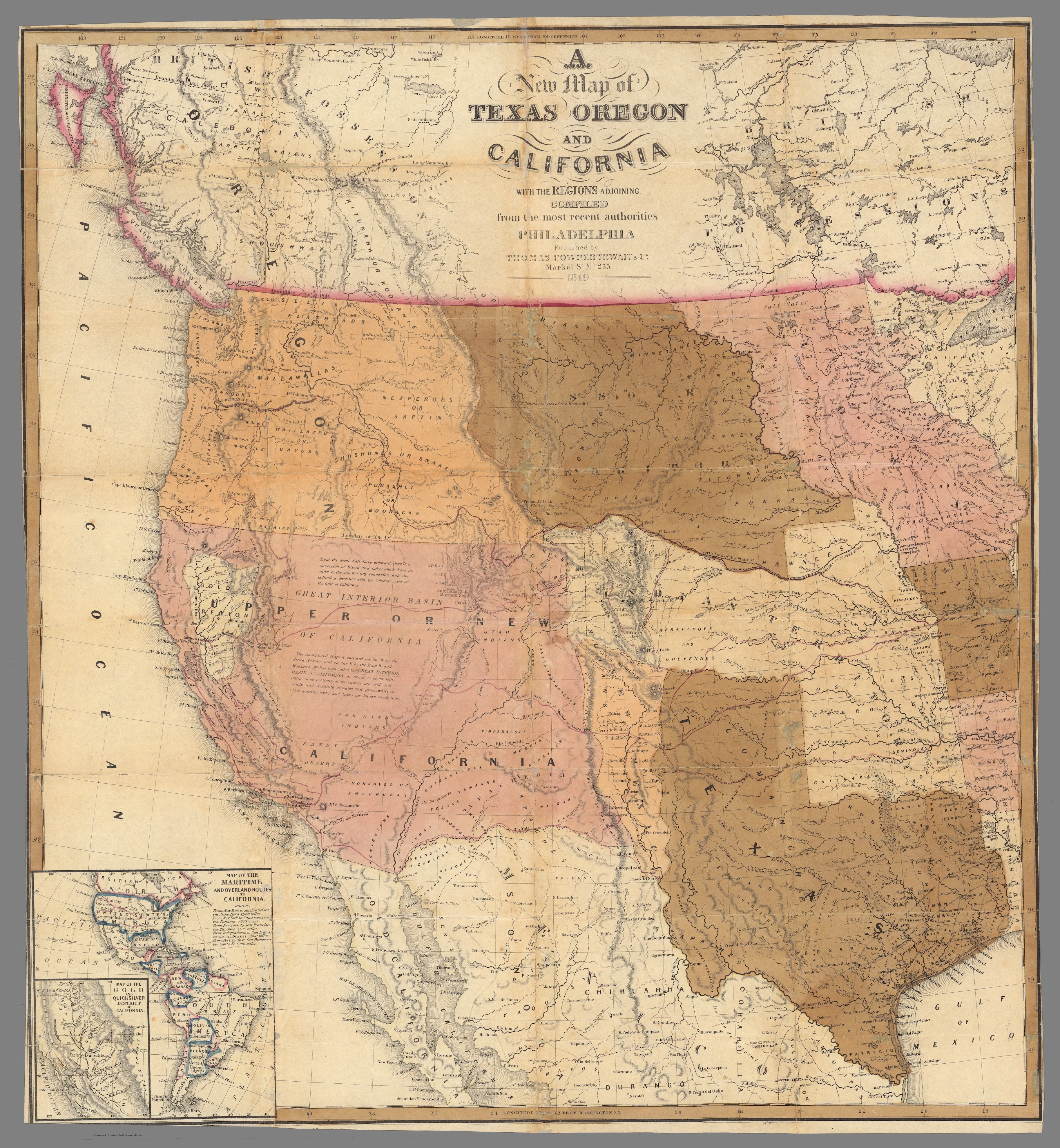
The U.S. victory in the Mexican-American War, fought from 1846-1848, ended the Mexican claim over Texas and forced Mexico to cede vast western territories, including California. This pushed the American boundary all the way to the Pacific Ocean, at a time when the limit of western settlement in Texas was the Hill Country.
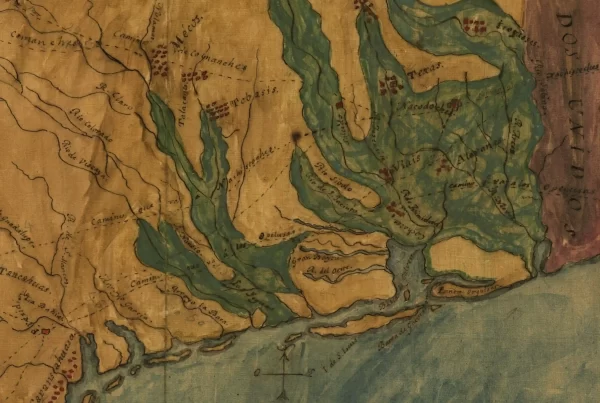
The rest of Texas in 1849 remained under the control of the Comanche, Apache, and Kiowa, and other Native tribes. On this map, the westernmost settlements indicated are Austin, “Waco village,” and San Antonio, though by this point German immigrants also had founded Fredericksburg farther to the west.
Historical Context
When this map was created, the “gold rush” had just begun in California, Mormons had recently settled in Utah, and the “Oregon Trail” was a key settler route to the Pacific. Congress had organized the Oregon territory in 1848, following a treaty with Great Britain in 1846, which set the boundary between Canada and the U.S. at the 49th parallel.
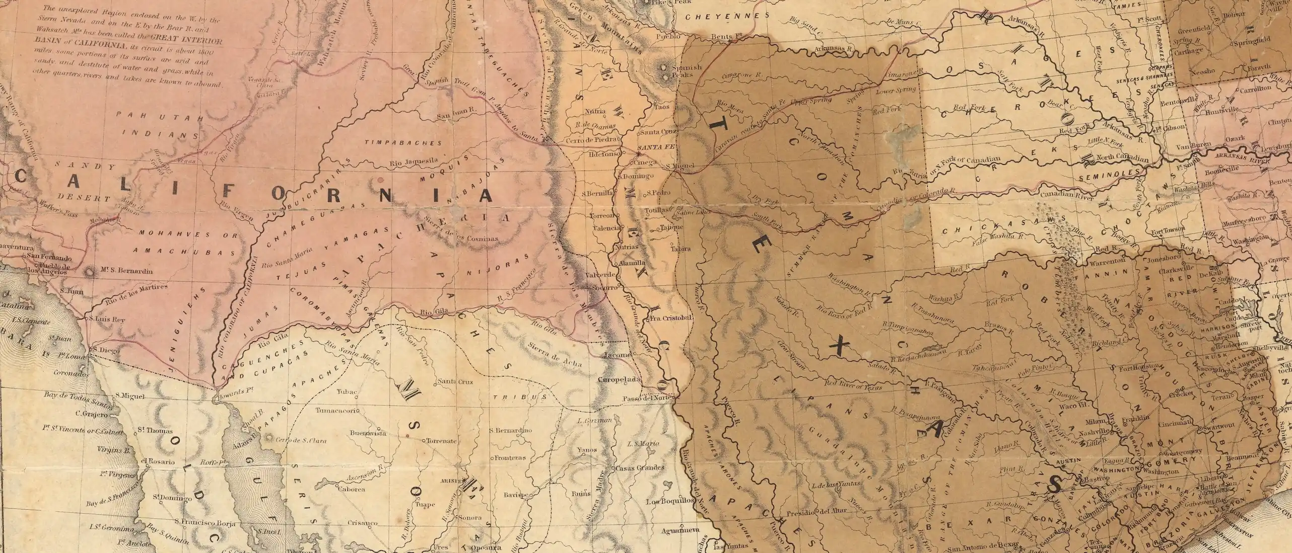
A handful of military posts were scattered across the plains and Southwest, including in the recently conquered territories of California and New Mexico. Unlike some earlier maps from the 1840s, this map accurately shows New Mexico as a distinct political and geographic entity, rather than a part of Texas. During the Republic era, the Texan government had claimed New Mexico, and attempted to invade, but did not exert control over it.
The acquisition of vast new U.S. territories in the 1840s (including Texas, annexed in December 1845) sharpened sectarian divisions over slavery. The road to Civil War in 1861 began not just with general ideological differences over slavery, but with specific political battles over whether new territories and states in the West should be admitted as slave states or free states.
Each new territory formed and each state admitted to the Union had the potential to shift the balance of power in the U.S. Congress the pro-slavery and anti-slavery camps. These tensions would flare in the years after this map was produced, including in “Bleeding Kansas,” where guerrilla warfare between abolitionists and pro-slavery settlers broke out in the 1850s.
Map Details
Titled “A New Map of Texas, Oregon and California With The Regions Adjoining,” this map was compiled by Samuel Augustus Mitchell and published in 1849 by Thomas, Cowperthwait & Co. in Philadelphia, accompanying the book Overland Guide to California and Oregon (cover page title: “Description of Oregon and California, embracing An Account of The Gold Regions; to which is added, An Appendix, containing descriptions of various kinds of gold, and methods of testing its genuineness”). This map was digitized by the David Rumsey Map Center, Stanford Libraries. It is reproduced here under a Creative Commons License.