The Spanish Empire controlled parts of Texas throughout the 1700s, following the conquest of central Mexico two hundred years earlier. The northern frontier was settled by a mix of Franciscan missionaries, soldiers, and a small civil population resettled from the Canary Islands and parts of Mexico.
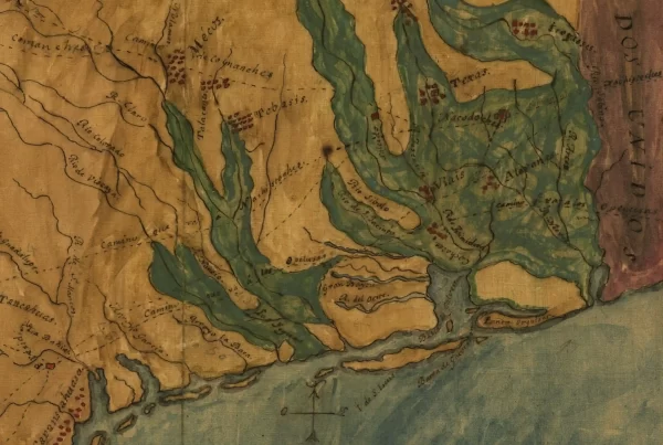
In 1765, King Carlos commissioned the Marqués de Rubí, a Spanish nobleman, to inspect the presidios (forts) of the northern frontier of New Spain from Louisiana to California. Rubí undertook a two-year expedition to fulfill the commission. He brought with him royal engineer Nicolás de Lafora and military cartographer José de Urruti, who produced this map circa 1769.
At the time, the Spanish settlements of Texas and New Mexico suffered constantly from Apache raids. To consolidate military resources across the sparsely settled frontier, Rubí ordered the abandonment of the San Sabá mission, Los Adaes, and several other forts and settlements in Texas and elsewhere.
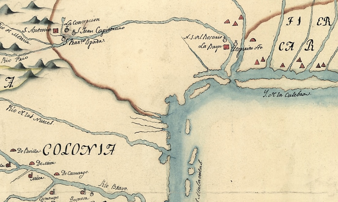
The map shows the main areas of Spanish missionary activity in present-day Texas at the Matagorda Bay, San Antonio, and along the Rio Bravo (Rio Grande).
Notably, the map shows a distinct political boundary between the Province of Texas and the “Land of the Karankawa Indians” in coastal Texas, which eventually became the main region of Anglo settlement after Mexican Independence in the 1820s. A decade after this map was produced, the Karankawas fought a war with the Spanish, and they were devastated by a smallpox epidemic.
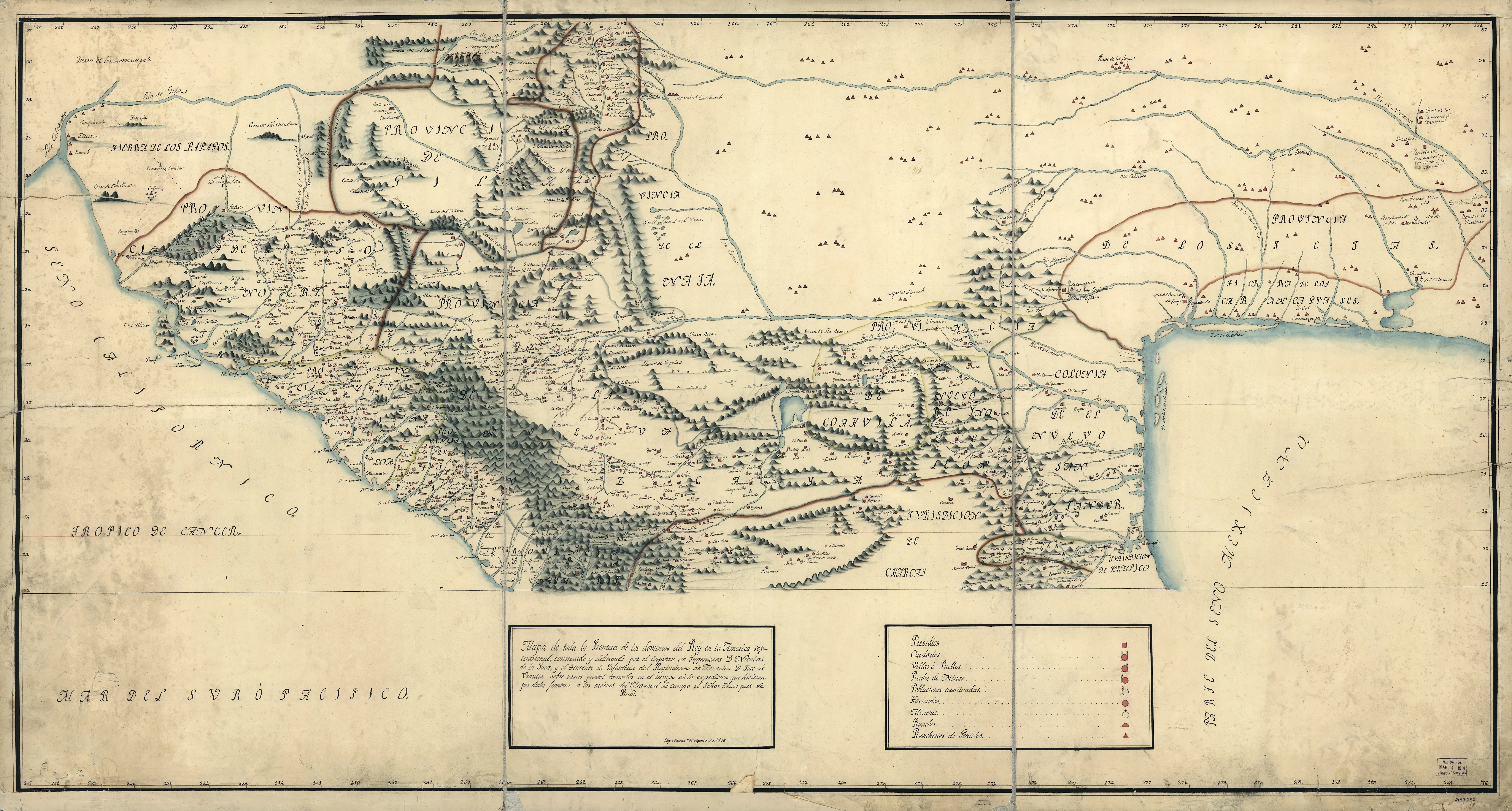
Translation of the Map Legend:
- Red squares: Forts (presidios)
- Red squares with two towers: Cities
- Red squares with one tower on right side: Villages
- Red squares with tower on left side: Royal mines
- White circles with tower on left side: Ruined towns (several of these are seen in New Mexico, due to Apache raids)
- Red circles: Haciendas (estates/land grants)
- White circles with cross: Missions
- Red half-circles: Ranches
- Teepees (red triangles): Native American populations
Manuscript Information: This scan shows a copy of the 1769 original, made in Mexico in 1815, which is held by the Library of Congress Geography and Map Division.