The late 19th century was a transformative period for Texas, as the state shifted from its frontier roots into an increasingly industrial and interconnected economy. Railroads played a central role in this transition, knitting together distant farming communities, cattle ranges, and emerging urban centers. By the 1880s, Texas had one of the largest railroad networks in the country, reflecting both private ambition and public urgency to modernize infrastructure.
This rapid expansion led to widespread concerns about monopolistic practices and uneven freight rates, particularly among rural shippers. In response, the Texas Legislature established the Railroad Commission in 1887 (formally beginning operations in 1891) to regulate freight charges and protect small producers from exploitative pricing, marking one of the first major regulatory efforts of its kind in the United States.
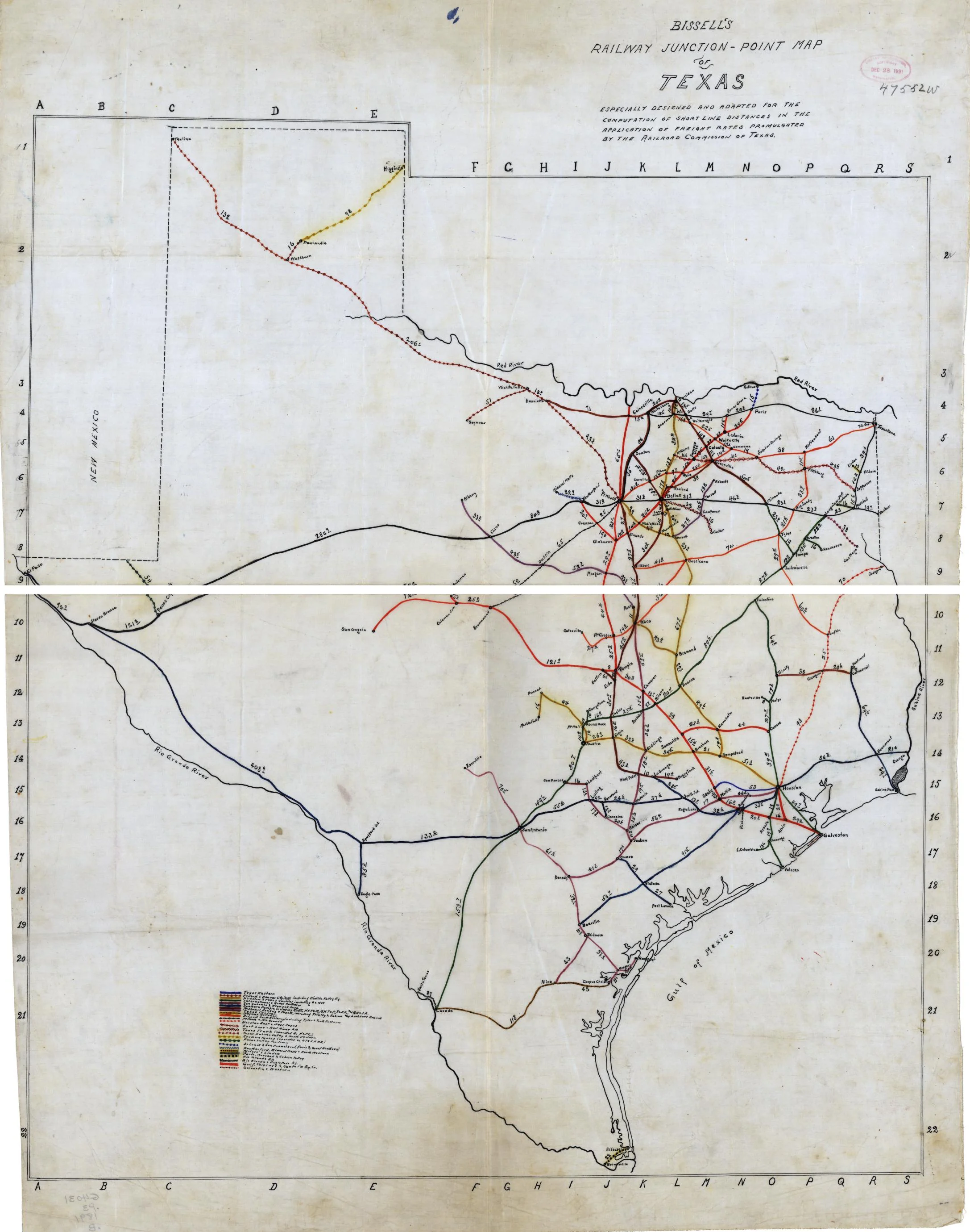
Bissell’s Railway Junction Point Map of Texas, published in 1891 for the Railroad Commission, reflects both the scope of the rail system and the state’s attempt to bring order to it. The map highlights key junction points across Texas and delineates rate zones used to determine freight charges—a tool essential for the Commission’s regulatory work.
Color-coded lines identify the routes of various railroad companies, revealing the complex web of overlapping claims and service areas. Urban centers like Fort Worth, Dallas, and Houston stand out as major nodes, while the map’s structure emphasizes how smaller towns were drawn into statewide and national markets through rail connections.
This article is part of Texapedia’s curated primary source collection, which makes accessible both famous and forgotten historical records. Each source is presented with historical context and manuscript information. This collection is freely available for classroom use, research, and general public interest.